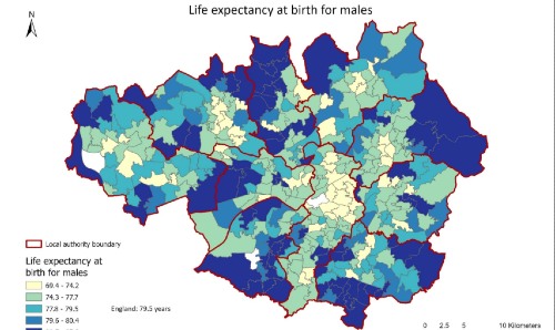
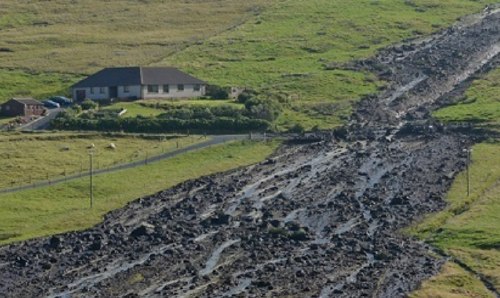
Planning, Property and Environmental ManagementResearchGroupsSpatial Policy and Analysis Laboratory (SPAL)StoryMaps Planning, Property and Environmental Management Research Groups Spatial Policy and Analysis Laboratory (SPAL) StoryMaps StoryMaps Discover our research findings in insightful map visualisations. Understanding health inequalities from a spatial perspective Collaborative research with Greater Manchester Combined Authority and Tameside & Glossop NHS Foundation Trust. Exploring Flood Risk and Natural Flood Management Responses A story map from PERI-CENE.